Employers slowed hiring in April, report showsIt's a sign that the American job market may be shifting into a lower gear this spring, a move that has been expected and hoped for by economists for a...Resume03:41May 3, 2024College newspaper editors reflect on the politics of campus protestsCollege protests are reverberating politically on campus as commencement approaches.Resume07:35May 3, 2024Week in politics centers around campus protestsThis week in politics has seen party divides.Resume04:07May 3, 2024Songwriter-poet Valerie June breaks genre barriersSinger, poet and fashion icon Valerie June from May 2023. She's on tour beginning later this month.Resume10:59May 3, 2024Biden awards Presidential Medals of FreedomAmong the recipients of the nation's highest civilian honor is Opal Lee, who led the effort to get Juneteenth recognized as a national holiday.Resume00:36May 3, 2024AdvertisementHundreds of comedians perform at Netflix Is A Joke festivalFrom now until May 12, some 300 comedians are taking over some of LA’s most iconic theaters to do live stand-up, table reads, sketch comedy shows and more.Resume05:47May 3, 2024Can you survive summer indoors without AC? In Arizona, many don’tNearly half of the people who suffered heat-related deaths in Arizona last year lived outdoors without shelter, but public health officials and lawmakers are starting to pay more attention to...Resume09:03May 3, 2024America's first major offshore wind farm is up and running. What's next for the industry?Giant turbines spinning off the coast of Montauk are bringing New Yorkers enough renewable electricity to power more than 70,000 homes.Resume05:44May 3, 2024The political lessons Biden should take from 1968In 1968, anti-Vietnam War protests caused upheaval on campuses across the country.Resume09:32May 3, 2024'SpongeBob SquarePants' celebrates 25 years on airNickelodeon's megahit show "SpongeBob SquarePants" made its TV debut on May 1, 1999.Resume03:37May 3, 2024Journalist working to create missing Indigenous people databaseThere is a glaring data hole when it comes to records of people who are missing from reservations.Resume06:20May 3, 2024Republicans in Congress propose excluding noncitizens from census apportionment countsThe 14th Amendment specifies that a key census count must include the "whole number of persons in each state." But a growing number of Republicans are proposing measures to exclude...Resume04:20May 3, 2024Trump's trial continues with testimony on a recorded conversation A forensic analyst continues testimony Friday about a recording of Trump talking with his then-fixer Michael Cohen about payments to adult film star Stormy Daniels.Resume05:41May 3, 2024Here's what protections the First Amendment offers pro-Palestinian protestorsProtestors at pro-Palestinian encampments on college campuses across the United States say they are exercising their constitutionally protected right to free speech.Resume05:46May 3, 2024Nurse recounts treating patients in GazaWe speak with a nurse who returned from working in Gaza earlier this week.Resume07:31May 2, 2024How Northwestern University reached a deal with campus protestorsThe university and campus protestors reached a deal this week where both sides got some of what they wanted.Resume06:20May 2, 2024Mayors address homelessness, affordable housing at White HouseThe mayors are looking for more federal help to address the crisis in homelessness and the urgent need for affordable housing.Resume05:18May 2, 2024Nonesuch record label celebrates 60 years of musicThe label has released music from artists as varied as the Kronos Quartet, the Black Keys, Rhiannon Giddens and Brad Mehldau.Resume11:07May 2, 2024United Methodist Church reverses ban on LGBTQ clergy and on ministers officiating same-sex weddingsIn the five years since the Methodist Church’s last meeting, there’s been a split between more conservative Methodist congregations and more liberal ones. Resume05:33May 2, 2024Colombian musicians take on the New Orleans Jazz and Heritage FestivalThe famous New Orleans Jazz and Heritage Festival is back this weekend for another round of great food and outstanding music. Resume09:29May 2, 2024Next Page
Employers slowed hiring in April, report showsIt's a sign that the American job market may be shifting into a lower gear this spring, a move that has been expected and hoped for by economists for a...Resume03:41May 3, 2024
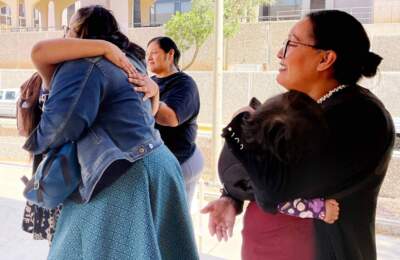
College newspaper editors reflect on the politics of campus protestsCollege protests are reverberating politically on campus as commencement approaches.Resume07:35May 3, 2024
Week in politics centers around campus protestsThis week in politics has seen party divides.Resume04:07May 3, 2024
Songwriter-poet Valerie June breaks genre barriersSinger, poet and fashion icon Valerie June from May 2023. She's on tour beginning later this month.Resume10:59May 3, 2024
Biden awards Presidential Medals of FreedomAmong the recipients of the nation's highest civilian honor is Opal Lee, who led the effort to get Juneteenth recognized as a national holiday.Resume00:36May 3, 2024
Hundreds of comedians perform at Netflix Is A Joke festivalFrom now until May 12, some 300 comedians are taking over some of LA’s most iconic theaters to do live stand-up, table reads, sketch comedy shows and more.Resume05:47May 3, 2024
Can you survive summer indoors without AC? In Arizona, many don’tNearly half of the people who suffered heat-related deaths in Arizona last year lived outdoors without shelter, but public health officials and lawmakers are starting to pay more attention to...Resume09:03May 3, 2024
America's first major offshore wind farm is up and running. What's next for the industry?Giant turbines spinning off the coast of Montauk are bringing New Yorkers enough renewable electricity to power more than 70,000 homes.Resume05:44May 3, 2024
The political lessons Biden should take from 1968In 1968, anti-Vietnam War protests caused upheaval on campuses across the country.Resume09:32May 3, 2024
'SpongeBob SquarePants' celebrates 25 years on airNickelodeon's megahit show "SpongeBob SquarePants" made its TV debut on May 1, 1999.Resume03:37May 3, 2024
Journalist working to create missing Indigenous people databaseThere is a glaring data hole when it comes to records of people who are missing from reservations.Resume06:20May 3, 2024
Republicans in Congress propose excluding noncitizens from census apportionment countsThe 14th Amendment specifies that a key census count must include the "whole number of persons in each state." But a growing number of Republicans are proposing measures to exclude...Resume04:20May 3, 2024
Trump's trial continues with testimony on a recorded conversation A forensic analyst continues testimony Friday about a recording of Trump talking with his then-fixer Michael Cohen about payments to adult film star Stormy Daniels.Resume05:41May 3, 2024
Here's what protections the First Amendment offers pro-Palestinian protestorsProtestors at pro-Palestinian encampments on college campuses across the United States say they are exercising their constitutionally protected right to free speech.Resume05:46May 3, 2024
Nurse recounts treating patients in GazaWe speak with a nurse who returned from working in Gaza earlier this week.Resume07:31May 2, 2024
How Northwestern University reached a deal with campus protestorsThe university and campus protestors reached a deal this week where both sides got some of what they wanted.Resume06:20May 2, 2024
Mayors address homelessness, affordable housing at White HouseThe mayors are looking for more federal help to address the crisis in homelessness and the urgent need for affordable housing.Resume05:18May 2, 2024
Nonesuch record label celebrates 60 years of musicThe label has released music from artists as varied as the Kronos Quartet, the Black Keys, Rhiannon Giddens and Brad Mehldau.Resume11:07May 2, 2024
United Methodist Church reverses ban on LGBTQ clergy and on ministers officiating same-sex weddingsIn the five years since the Methodist Church’s last meeting, there’s been a split between more conservative Methodist congregations and more liberal ones. Resume05:33May 2, 2024
Colombian musicians take on the New Orleans Jazz and Heritage FestivalThe famous New Orleans Jazz and Heritage Festival is back this weekend for another round of great food and outstanding music. Resume09:29May 2, 2024