Allyson Felix and Tianna Madison on Tori Bowie's death and Black maternal health careLast year on April 23, Olympic gold medalist and world-champion American sprinter Tori Bowie was found dead in her Florida home at the age of 32. An autopsy found that...Resume09:453 hours agoIn 'Replay,' video game pioneer Jordan Mechner explores his Jewish family's story of survivalThe graphic novel interweaves his personal history with the story of how his grandfather and father fled Vienna to escape the Nazis.Resume10:483 hours agoWeek in politics: Israel retaliates against Iran, Trump's criminal trialThe Biden administration says the U.S. was not involved in Israel’s attack on Iran on Friday.Resume11:283 hours agoHow Bakersfield, California, and Burlington, Vermont, are addressing homelessnessThe number of people experiencing homelessness reached a record high in 2023, up 12% from the previous year.Resume10:373 hours agoIsrael launches limited retaliatory military strike against IranThere’s growing concern that intensifying conflict between Iran and Israel could develop into a regional war. Resume06:053 hours agoAdvertisementWhy critics are concerned about H-Pop, India's Hindu nationalist genreWith an election underway, some critics are warning H-Pop may have destructive power.Resume05:383 hours agoNetflix stock takes a tumble despite strong start to 2024The company says it will no longer share quarterly subscriber numbers starting in 2025.Resume03:413 hours ago'Lessons for Survival' reflects on motherhood, racial justice and climate changeAuthor, photographer and professor Emily Raboteau wrote the new essay collection "Lessons for Survival: Mothering Against 'The Apocalypse.'"Resume09:193 hours ago'Shogun' finale: What to expect'Shogun' is based on James Clavell's 1975 book. Resume05:513 hours agoWhy Instagram users are hiding their photosInstagram grids increasingly have zero photos. Young people are driving this trend by prioritizing fleeting and private engaging over permanent interactions.Resume03:493 hours agoPro-Palestinian demonstrations grow around the U.S.More than a hundred students protesting at Columbia University were arrested Thursday night.Resume05:383 hours agoColumbia president testifies on antisemitismMinouche Shafik was scrutinized for three hours by Congress about how Columbia has been fighting antisemitism on campus.Resume06:13Apr 18, 2024Russian airstrike kills 18 in Chernihiv, UkraineUkrainian President Volodymyr Zelensky wrote on Telegram that the attack could have been thwarted if Ukraine had adequate air defense systems.Resume05:13Apr 18, 2024Helping game fish survive in FloridaWith strict catch limits, more than half of the fish caught by recreational fishermen in Florida are returned to the water. Efforts are underway to ensure that the released fish...Resume03:41Apr 18, 2024'Other People's Words' explores how others' voices make up our ownIn the book, author Lissa Soep remembers two close friends who died and reflects on how their voices continue to speak through their loved ones.Resume09:40Apr 18, 2024How Vice Media went bust after a multi-billion dollar valuationVice grew into a $5.7 billion behemoth. It’s now a bare shadow of itself.Resume06:24Apr 18, 2024Boeing whistleblowers testify in Senate hearingsSenators heard from engineers, managers and others about failings at the company, and allegations that some of those workers were harassed to stay quiet.Resume05:18Apr 18, 2024Bernie Sanders proposes new program aimed at researching long COVID therapiesVermont Sen. Bernie Sanders has drafted a $10 billion proposal to fund the National Institute of Health's research toward designing new therapies to treat long COVID.Resume05:46Apr 18, 2024'Landslide' podcast traces the roots of our political divideIt centers on the 1976 presidential race, the tightest primary ever and the sharp rise of the conservative wing of the Republican party.Resume09:42Apr 18, 2024Trump's alleged 'hush money' scheme, explainedNew York district attorney Alvin Bragg says the case is really about trying to influence the 2016 election outcome.Resume10:59Apr 18, 2024Next Page
Allyson Felix and Tianna Madison on Tori Bowie's death and Black maternal health careLast year on April 23, Olympic gold medalist and world-champion American sprinter Tori Bowie was found dead in her Florida home at the age of 32. An autopsy found that...Resume09:453 hours ago
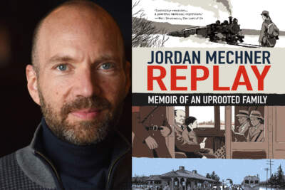
In 'Replay,' video game pioneer Jordan Mechner explores his Jewish family's story of survivalThe graphic novel interweaves his personal history with the story of how his grandfather and father fled Vienna to escape the Nazis.Resume10:483 hours ago
Week in politics: Israel retaliates against Iran, Trump's criminal trialThe Biden administration says the U.S. was not involved in Israel’s attack on Iran on Friday.Resume11:283 hours ago
How Bakersfield, California, and Burlington, Vermont, are addressing homelessnessThe number of people experiencing homelessness reached a record high in 2023, up 12% from the previous year.Resume10:373 hours ago
Israel launches limited retaliatory military strike against IranThere’s growing concern that intensifying conflict between Iran and Israel could develop into a regional war. Resume06:053 hours ago
Why critics are concerned about H-Pop, India's Hindu nationalist genreWith an election underway, some critics are warning H-Pop may have destructive power.Resume05:383 hours ago
Netflix stock takes a tumble despite strong start to 2024The company says it will no longer share quarterly subscriber numbers starting in 2025.Resume03:413 hours ago
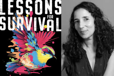
'Lessons for Survival' reflects on motherhood, racial justice and climate changeAuthor, photographer and professor Emily Raboteau wrote the new essay collection "Lessons for Survival: Mothering Against 'The Apocalypse.'"Resume09:193 hours ago
'Shogun' finale: What to expect'Shogun' is based on James Clavell's 1975 book. Resume05:513 hours ago
Why Instagram users are hiding their photosInstagram grids increasingly have zero photos. Young people are driving this trend by prioritizing fleeting and private engaging over permanent interactions.Resume03:493 hours ago
Pro-Palestinian demonstrations grow around the U.S.More than a hundred students protesting at Columbia University were arrested Thursday night.Resume05:383 hours ago
Columbia president testifies on antisemitismMinouche Shafik was scrutinized for three hours by Congress about how Columbia has been fighting antisemitism on campus.Resume06:13Apr 18, 2024
Russian airstrike kills 18 in Chernihiv, UkraineUkrainian President Volodymyr Zelensky wrote on Telegram that the attack could have been thwarted if Ukraine had adequate air defense systems.Resume05:13Apr 18, 2024
Helping game fish survive in FloridaWith strict catch limits, more than half of the fish caught by recreational fishermen in Florida are returned to the water. Efforts are underway to ensure that the released fish...Resume03:41Apr 18, 2024
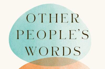
'Other People's Words' explores how others' voices make up our ownIn the book, author Lissa Soep remembers two close friends who died and reflects on how their voices continue to speak through their loved ones.Resume09:40Apr 18, 2024
How Vice Media went bust after a multi-billion dollar valuationVice grew into a $5.7 billion behemoth. It’s now a bare shadow of itself.Resume06:24Apr 18, 2024
Boeing whistleblowers testify in Senate hearingsSenators heard from engineers, managers and others about failings at the company, and allegations that some of those workers were harassed to stay quiet.Resume05:18Apr 18, 2024
Bernie Sanders proposes new program aimed at researching long COVID therapiesVermont Sen. Bernie Sanders has drafted a $10 billion proposal to fund the National Institute of Health's research toward designing new therapies to treat long COVID.Resume05:46Apr 18, 2024
'Landslide' podcast traces the roots of our political divideIt centers on the 1976 presidential race, the tightest primary ever and the sharp rise of the conservative wing of the Republican party.Resume09:42Apr 18, 2024
Trump's alleged 'hush money' scheme, explainedNew York district attorney Alvin Bragg says the case is really about trying to influence the 2016 election outcome.Resume10:59Apr 18, 2024